Статті
Satellite images indicate serious damage to the Druzhba oil pipeline
In late January, Ukraine halted oil transit through the Druzhba oil pipeline, citing damage caused by a Russian attack. Hungary and Slovakia do not believe these claims and accuse Kyiv of artificially halting supplies.
Texty.org.ua reviewed publicly available data to determine the likelihood that the oil pipeline sustained serious damage.
According to Interfax-Ukraine, citing Minister of Energy of Ukraine Denys Shmyhal, the internal components of the oil pipeline have sustained significant damage. A few days earlier, media reports indicated that an independent EU commission was set to arrive in Ukraine to inspect the oil pipeline; however, on March 18, the Ministry of Foreign Affairs of Ukraine denied these reports.
We cannot look inside the oil pipeline, but satellite images allow us to assess the likelihood of serious damage indirectly.
Let’s start with NASA FRIMS, a service that tracks fires. Since January 2025, only one fire has been recorded at the oil pipeline facility near "Druzhba", and it occurred precisely in the days following the Russian attack on January 27, 2026.
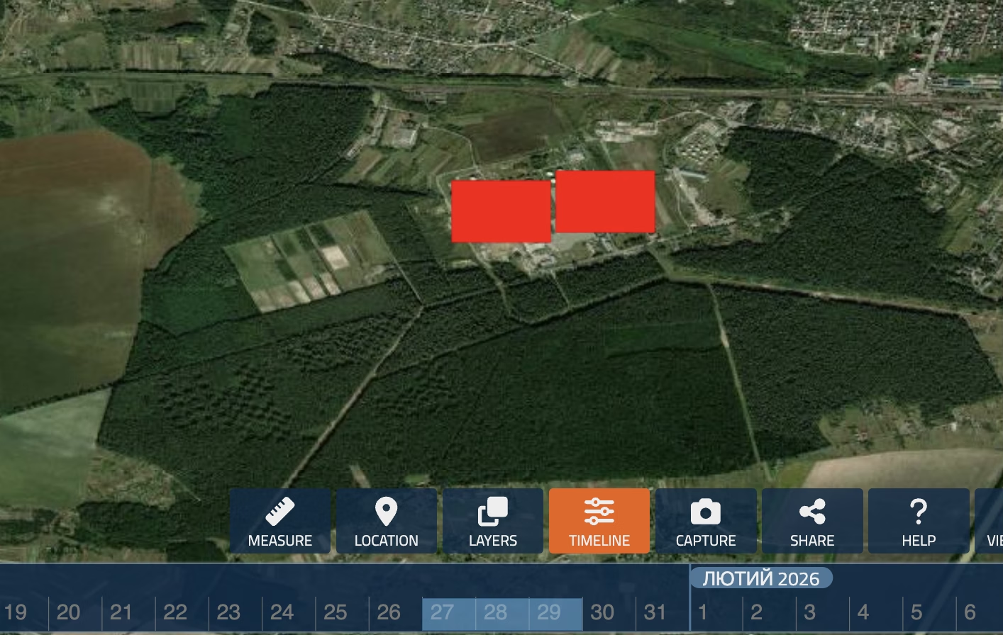
According to Denys Shmyhal, the drone struck the largest storage tank, which at the time contained 25,000 cubic meters of oil. This explains the scale of the fire.
We also assessed the potential damage to the facility using an algorithm based on Sentinel-1 proposed by British scientist and geospatial computing expert Ollie Ballinger. The algorithm confirms extensive damage to the facility as of January 27, 2026.
Pay attention to the fact that the satellite image below is a standard base map, similar to what you see on Google Maps, and does not correspond to the specified date. The affected areas are marked in purple on the map.
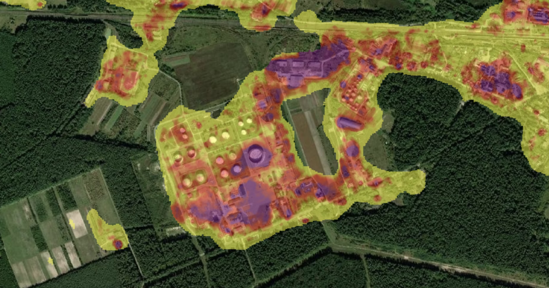
Due to the algorithm’s limitations, we cannot view the damage for a specific day or week. However, for comparison, we examined January 2025. There is virtually no damage visible in last year’s image. Given that there were no major fires at the facility during the year, it is logical to assume that most of the damage occurred on the day of the attack, January 27, 2026.
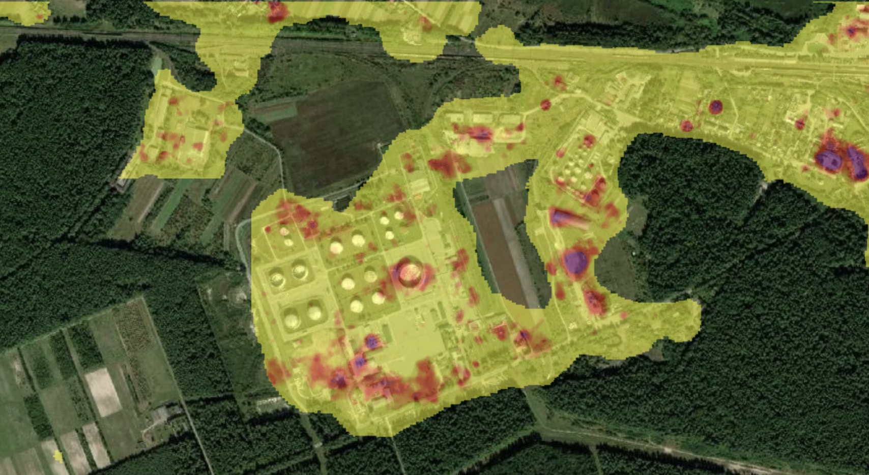
At the same time, certain changes at the facility were recorded as early as 2025 — without any accompanying fires, according to NASA. We cannot explain the cause of these changes. It is worth noting: the algorithm tracks not destruction per se, but significant changes in the condition of structures. Most of these changes are indeed caused by destruction, but, for example, installing protective structures at the facility can also trigger them. More details about these are in the spoiler below.
Sentinel-1 is a radar satellite that can see through clouds and at night. It measures not only the intensity of the reflected signal but also the phase of the radar wave — and this is what makes the method extremely sensitive. By comparing the phases of two images of the same location (interferometry, or InSAR), it is possible to detect surface changes at the centimeter level and below: ground subsidence, structural deformation, and displacement. If the phase changes sharply at a point between images, something has happened there. A phase change in itself does not necessarily indicate damage, but damage is the most common cause of such changes in active combat zones.

Підпишіться, щоб отримувати найкращі статті на e-mail (раз на два тижні)
Підписатися