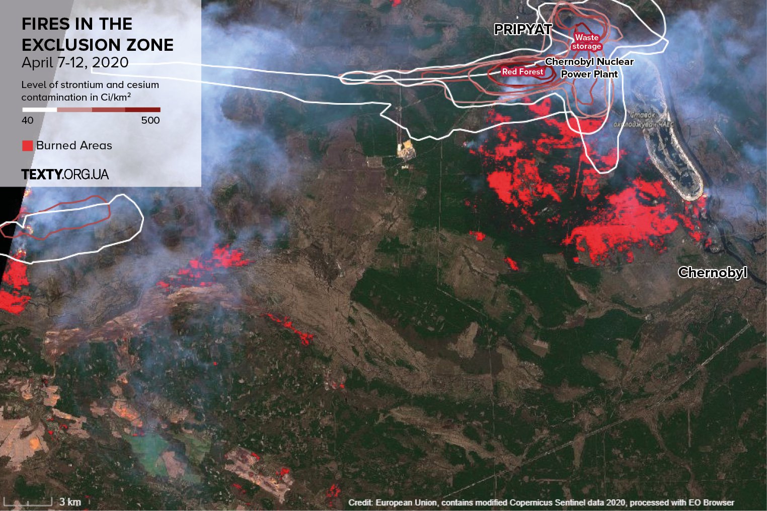
MAP: Fires in Chornobyl exclusion zone get out of control
Fires raging in Chornobyl (aka Chernobyl) exclusion zone get to the areas most affected with radiation.

The satellite map shows that as of April 12 (due to strong winds, the situation changes hourly), the fires in Chornobyl exclusion zone covered hundreds of hectares.
The fire began to reach the most radiation-contaminated parts of the exclusion zone, even the infamous Red Forest, the wooded territories adjacent to the Chornobyl Neclear Power Plant which received the largest share of radioactive dust.
This means that in addition to the smoke, a significant number of radioactive isotopes which had been bound in soil and plants, can now get to cities and villages.

